
File:Map of the Khmer Empire, 1970.jpg

Original file (1,280 × 1,600 pixels, file size: 474 KB, MIME type: image/jpeg)
Summary
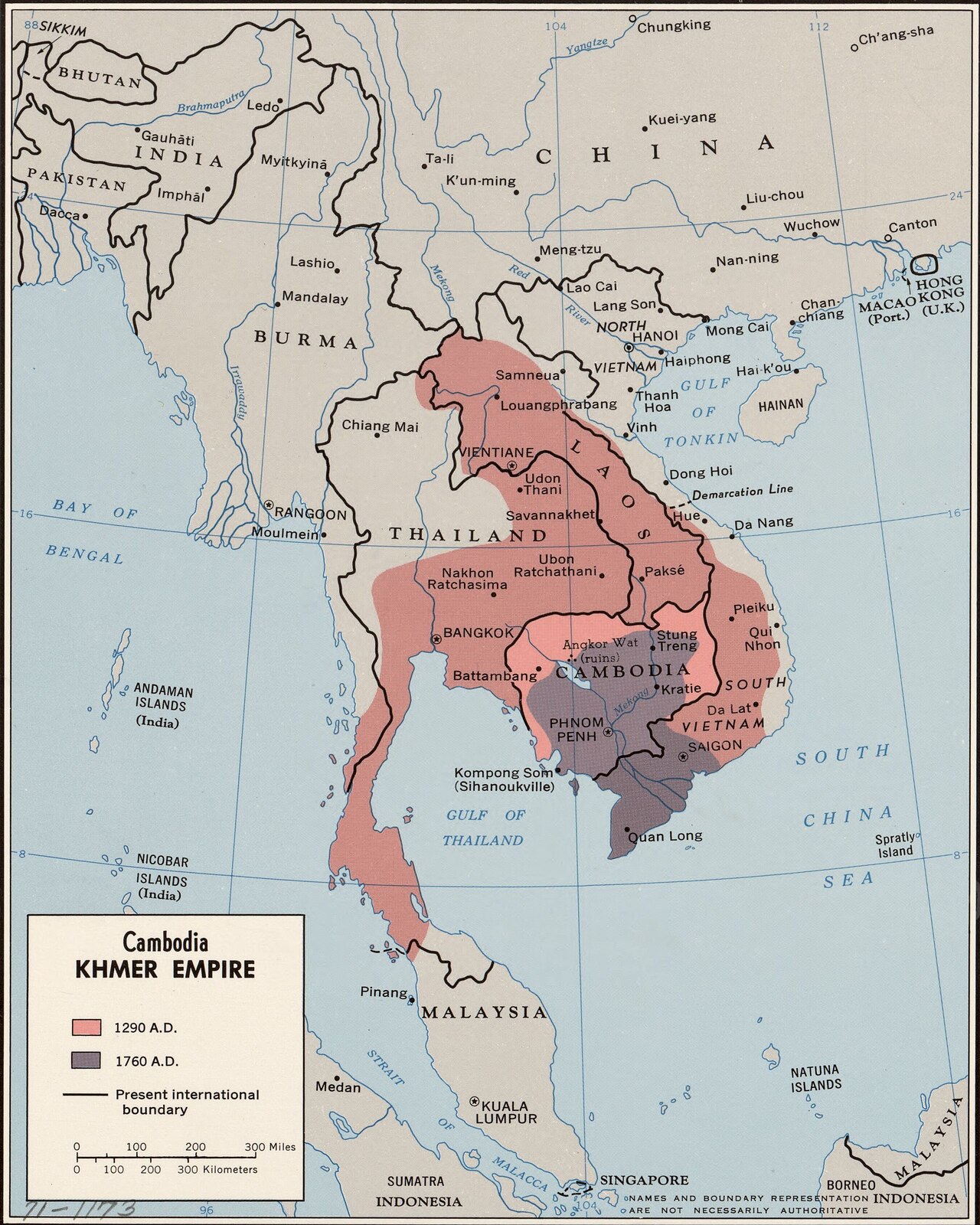
A 1970 map showing the extent of the Khmer Empire in 1290 and in 1760.
Shown on the Khmer Empire page.
Licensing
Public Domain
This file is in the public domain. It is free of known copyright restrictions, either because its copyright has expired or because it was never subject to copyright.
Source
https://commons.wikimedia.org/wiki/File:Cambodia,_Khmer_Empire._2-70._LOC_gm71001173_(cropped).jpg

Image by United States. Central Intelligence Agency, published on Wikimedia Commons as Cambodia, Khmer Empire. 2-70. LOC gm71001173 (cropped).jpg.
Resized from 2,702 x 3,377 pixels to 1,280 x 1,600 pixels.
File history
Click on a date/time to view the file as it appeared at that time.
| Date/Time | Thumbnail | Dimensions | User | Comment | |
|---|---|---|---|---|---|
| current | 00:21, 12 October 2026 | | 1,280 × 1,600 (474 KB) | Maintenance script (talk | contribs) | Photo from Wikimedia Commons, with the author and licence named. |
You cannot overwrite this file.
File usage
The following page uses this file:
